For nearly half a century, an impenetrable border divided Europe in two. The Iron Curtain, a system of walls, fences, watchtowers, minefields, and exclusion zones stretching from the Barents Sea to the Black Sea, separated NATO’s West from the Soviet-aligned East. Today, that border has been transformed into one of the world’s most extraordinary long-distance cycling routes: EuroVelo 13, the Iron Curtain Trail. At over 10,400 kilometers from Kirkenes in northern Norway to Tsarevo on the Bulgarian Black Sea coast, it is a journey through the physical remnants and living memory of the Cold War.
The Route at a Glance
The full trail passes through 20 countries, following the line where the Iron Curtain once stood. It traces the Finnish-Russian border, crosses the Baltic states, follows the former inner-German border, continues along the Czech-Austrian and Hungarian-Austrian frontiers, and winds through the Balkans to the Black Sea. Few cyclists ride the entire route, it would take several months, but the trail is designed to be ridden in sections, each with its own character and historical significance. The European Cyclists’ Federation maintains the route and provides detailed maps and GPS tracks.
Key Sections Worth Riding
The Inner-German Border
Perhaps the most evocative section runs along the former border between East and West Germany, now known as the Grunes Band (Green Belt). Because the death strip was off-limits for decades, it accidentally became a wildlife corridor, and today it is a protected nature reserve teeming with rare plants, birds, and animals. The cycling path passes preserved watchtowers, border marker stones, and open-air museums. The village of Modlareuth, known as Little Berlin because it was divided by a wall right through its center, is particularly powerful. The Point Alpha Memorial near Geisa, where American and Soviet troops stood just meters apart, brings the Cold War’s tension into vivid focus.
Czech-Austrian Border
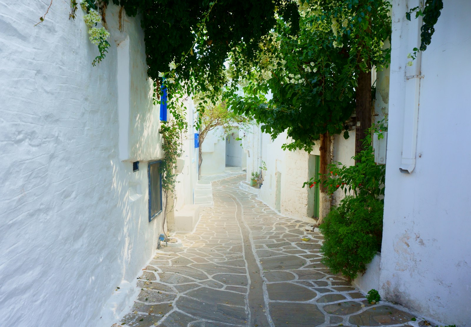
The section along the Czech-Austrian frontier passes through beautiful countryside that was once a forbidden zone. Towns like Slavonice on the Czech side were frozen in time by the Iron Curtain, their Renaissance architecture preserved because there was no development pressure during the communist era. Cycling this section, you pass through landscapes that look idyllic but hold dark stories: the ruins of villages demolished to create clear sight lines for border guards, and forests that still occasionally yield unexploded ordnance.
Berlin Wall Segments
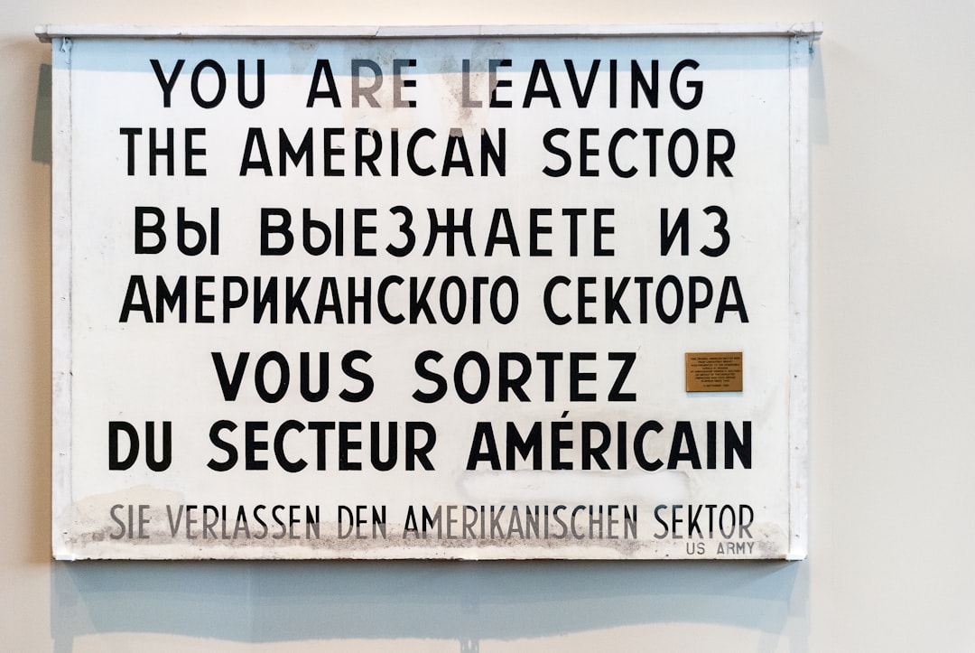
While not strictly part of the border trail, the Berlin Wall Trail (Berliner Mauerweg) is a 160-kilometer loop around what was once West Berlin, following the wall’s former route. Much of it is paved and well-signed, passing the East Side Gallery (the longest surviving stretch of the Wall, covered in murals), the memorial at Bernauer Strasse (which preserves a section of the wall with its death strip intact), and Checkpoint Charlie. The trail also runs through surprisingly rural areas in the city’s outskirts.
Practical Cycling Logistics
- Bike choice: A touring bike or gravel bike is ideal. Some sections are paved cycle paths, but others follow forest tracks, farm roads, and occasionally rough terrain.
- Accommodation: The route passes through towns regularly enough that camping is optional. Guesthouses, small hotels, and the occasional hostel are available along most sections.
- Season: May through September is best. The northern sections have shorter seasons; the Balkan sections can be very hot in midsummer.
- Navigation: The EuroVelo 13 route is variably signed depending on the country. GPS tracks from the EuroVelo website are essential. Germany and Austria have the best signage.
- Border crossings: Within the Schengen Area, borders are invisible. Some non-Schengen crossings require a brief passport check.
Riding the Iron Curtain Trail is more than a cycling holiday. It is a journey through one of the defining chapters of modern European history, experienced at the perfect pace, slow enough to notice the details, fast enough to feel the scale of what once divided an entire continent.
Leave a Reply